Relentless, life-threatening weather conditions continued into Sunday across multiple states, including the threat of severe flooding in Memphis, Tennessee, and Little Rock, Arkansas, and tornado watches in Louisiana, Alabama and Georgia.
Since Wednesday, at least 12 people have died amid the outbreak of severe weather, including a 9-year-old boy in Kentucky, who was swept away by floodwaters as he walked to a bus stop, and several people killed in southwestern Tennessee after a strong EF-3 tornado ripped through the city of Selmer.
The Arkansas Division of Emergency Management confirmed the state’s first storm-related death — a 5-year-old child found in a home in southwest Little Rock. The agency did not provide any other details of the child’s death but said it was related “to the ongoing severe weather in Arkansas.”
In Missouri, a 16-year-old firefighter responding responding to a reported water rescue, died in a vehicle crash on Friday in Beaufort, about 60 miles west of St. Louis, according to the Beaufort-Leslie Fire Protection District and a Missouri State Highway Patrol crash report.

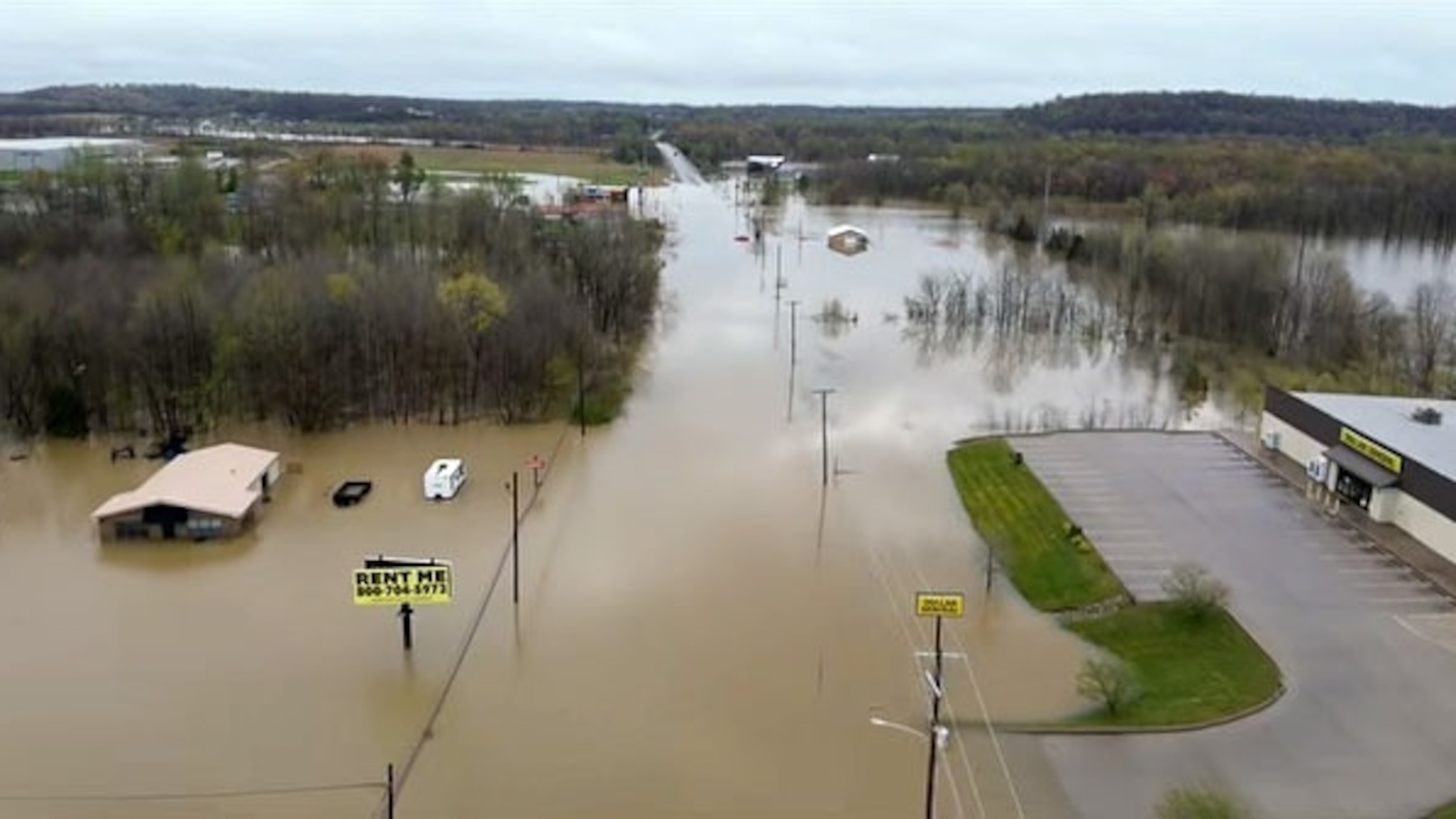
A drone view shows a flooded area, in Bellville, Ohio, on April 5, 2025.
Bryan Beal/@bryanrbeal/via Reuters
The firefighter was identified as Chevy Gall.
“Tonight is a fire chief’s worst nightmare,” Beaufort-Leslie Fire Protection District Chief Terry Feth said in a statement on Friday. “We are heartbroken by the loss of one of our own.”
Earlier this week, authorities in Missouri said another local fire chief, 68-year-old Garry Moore, died while helping a stranded driver on Wednesday. Moore was the chief of the Whitewater Fire Protection District.
Overall, the death toll stands at five in Tennessee; three in Missouri; two in Kentucky; and one each in Indiana and Arkansas.
Saturday was expected to the final day of a multi-day high impact flood event that has wreaked havoc across portions of the Lower and Mid-Mississippi River Valley, which remains under a high risk for flooding. ·
As of Sunday, at least 18 river gauges were in major flooding from Arkansas to Indiana. Up to 50 river gauges are expected to reach major flood stage in the Mid-South and the Midwest this week.

This ABC News graphic shows forecast extreme weather conditions through Sunday.
ABC News
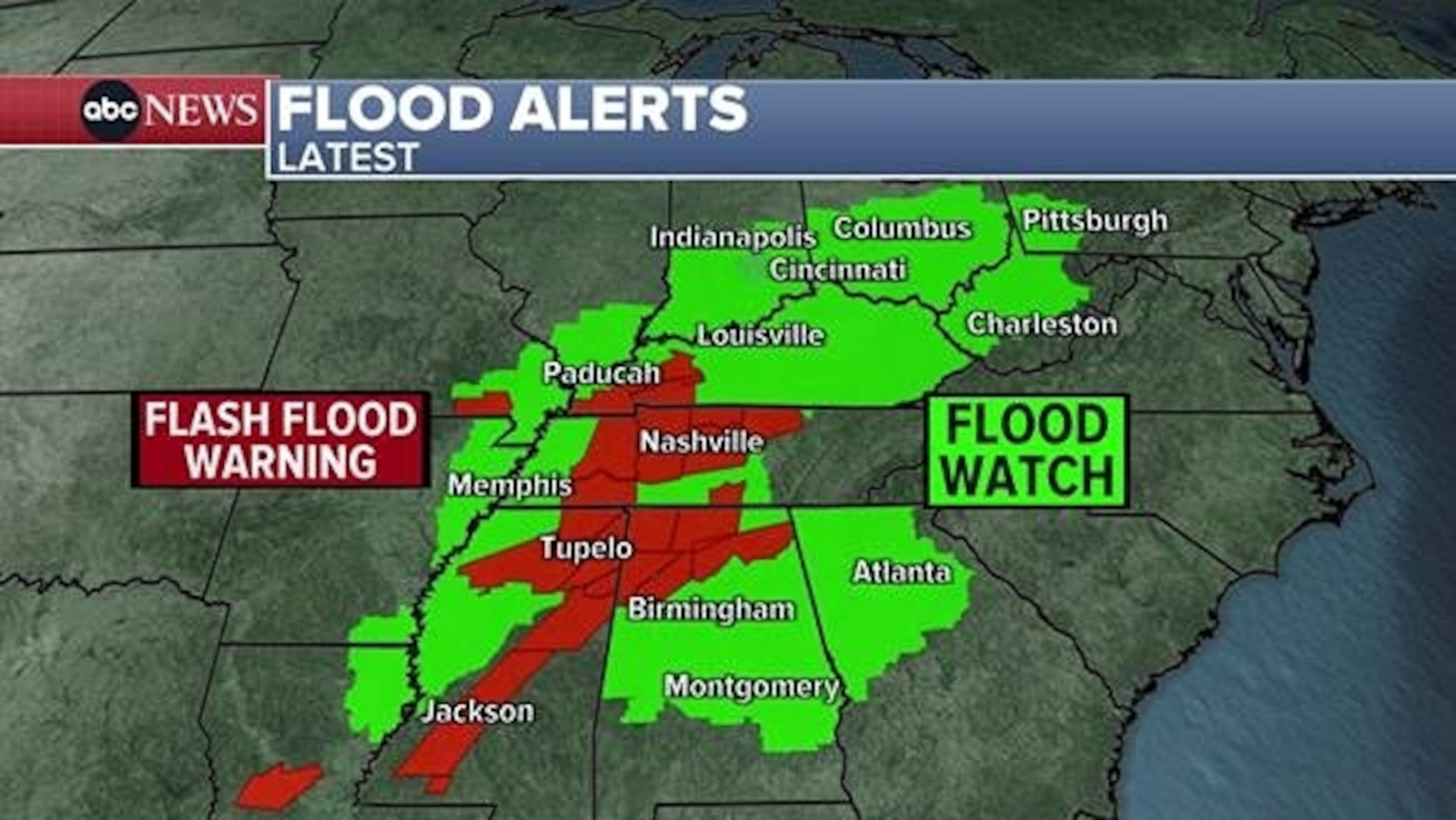
Sunday morning flood alerts stretched from Louisiana to western Pennsylvania, including major cities such as Atlanta, Nashville, Memphis, Birmingham, Louisville, Cincinnati and Pittsburgh.
The heavy rain was forecast to move east through Sunday, with the highest threat for flash flooding in Alabama and Georgia including Atlanta and Birmingham. Locally, more than 5 inches of rain is possible in the South through into Monday.
Since Friday, the highest rainfall total was reported in East Memphis where more than 14 inches of rain fell. At Memphis International Airport, more than 12 inches of rain was recorded, with the city recording its wettest ever April day on Saturday with 5.47 inches of rain.

In an aerial view, water covers roadways following extreme flooding that has caused significant damage throughout the area, on April 4, 2025, in Hopkinsville, Kentucky.
Jason Davis/Getty Images
As of Saturday evening, Memphis, Tennessee, remained under a flash flood emergency as the latest round of torrential rain continues to sweep east across parts of the mid-South Saturday afternoon.
The National Weather Service said it was a particularly dangerous situation and life-threatening flash flooding was expected. A flash flood emergency is the highest-level alert that the NWS issues for a flash flood threat.
In Arkansas over the past few days, up to a foot of rain has fallen — equal to about three months’ worth of rain.
By Saturday evening, a flash flood emergency issued earlier for the Little Rock area was canceled and the worst of the heavy rain was over there. However, major flash flooding continued in the region.

This ABC News graphic shows forecast extreme weather conditions through Sunday.
ABC News
Another flash flood emergency in northeastern Arkansas, including the towns of Cherokee Village and Hardy, was also canceled. Earlier Saturday, emergency management officials have relayed to the National Weather Service that multiple water rescues were ongoing in the area, which includes portions of Lawrence and Sharp counties.
According to state emergency management officials, preliminary damage reports in Arkansas included flooding on roadways, downed trees and power lines, water rescues and damage from a possible tornado near the city of Wynne. The National Weather Service has not yet confirmed the tornado.
Even though the threat for severe storms will gradually lessen over the weekend as the stationary front slowly pushes east, more unsettled weather will continue to erupt over the areas already hit hard by tornados and life-threatening flooding.

In this photo released by the Bartholomew County Sheriff’s Department, flooding is shown on April 5, 2025, in Bartholomew County in Indiana.
Bartholomew County Sheriff’s Department
As of Sunday, there had been 91 reported tornadoes in at least 10 states from Kansas to Ohio.
Sunday morning brought tornado warnings for areas including Birmingham and just outside of Atlanta. Severe thunderstorms could produce a tornadoes and damaging straight line winds today from southern Louisiana into Alabama and Georgia.

This ABC News graphic shows forecast extreme weather conditions through Sunday.
ABC News
On Monday, the severe risk moves into northern Florida, Georgia and into South Carolina. Damaging winds will be the biggest threat but an isolated tornado cannot be ruled out.
The threat for severe weather and excessive rainfall will ease on Sunday as this system begins to slide eastward. However, parts of the Tennessee and Ohio River Valley could see another 3 to 6 inches before this frontal boundary completely moves out of the region by Monday.

A water rescue takes place in flood waters in Bartholomew County, Indiana, on April 5, 2025.
Bartholomew County Sheriff’s Department
Parts of the Southeast were under a slight risk (level 2 of 5) for severe weather, where storms were expected to generate damaging winds, hail and isolated tornadoes.

This ABC News graphic shows forecast extreme weather conditions through Sunday.
ABC News
With that, thunderstorms generating heavy rainfall (with rates potentially reaching 2 to 3 inches per hour) could cause flash flooding in prone areas. A good portion of Georgia and Alabama, as well as parts of the Florida Panhandle, southern Mississippi and southeastern Louisiana were under a slight risk for flooding.

In this screen grab from a video, flooding is shown in Dawson Springs, Kentucky, on April 5, 2025.
Dawson Springs Police Department
-ABC News’ Shawnie Caslin Martucci contributed to this report.


