
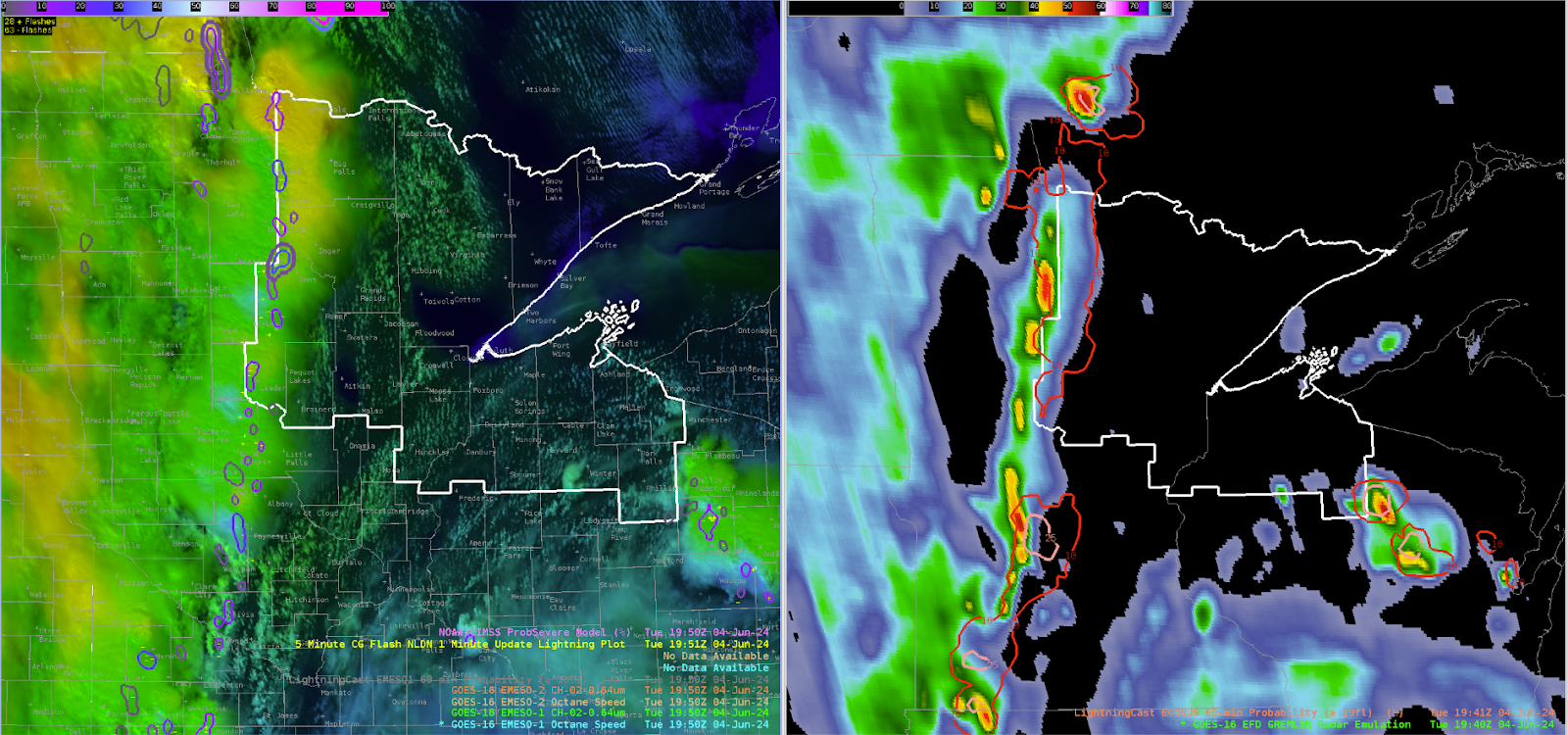
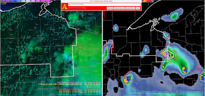
As of 20z, a strong line of thunderstorms associated with sharp mid-level shortwave and surface cold front is pushing across into central Minnesota. For a brief overview (DLH radar is down), GREMLIN shows a broken line of moderately strong convective cores dotted along this line, but overall the lightning production remains meager; LightningCast probability of greater than 10 strikes has only peaked out around 25% at any point within the line. The convective cluster sliding across northern Wisconsin remains the most highly active lightning producer around. OCTANE divergence fields further support the lack of strong-severe updrafts throughout the line for the time being.
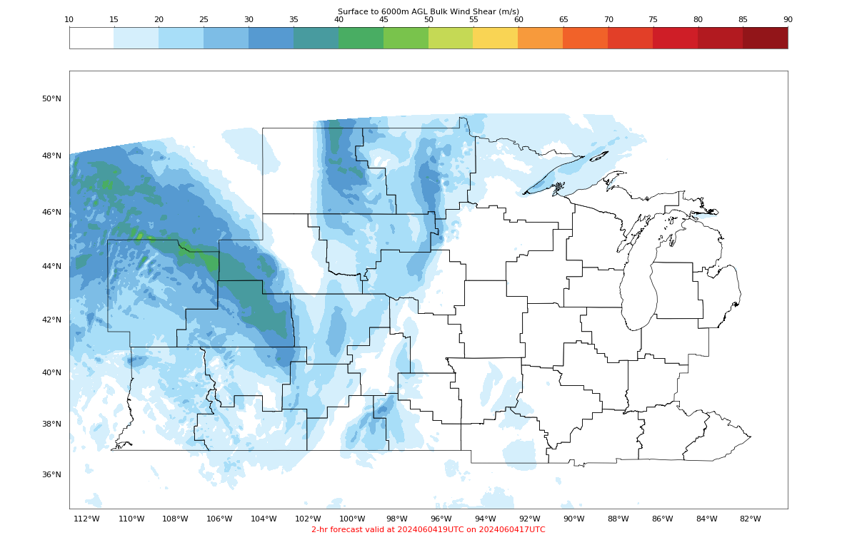
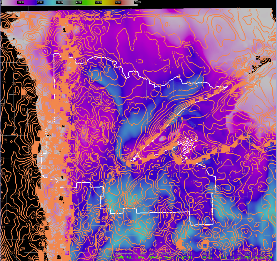
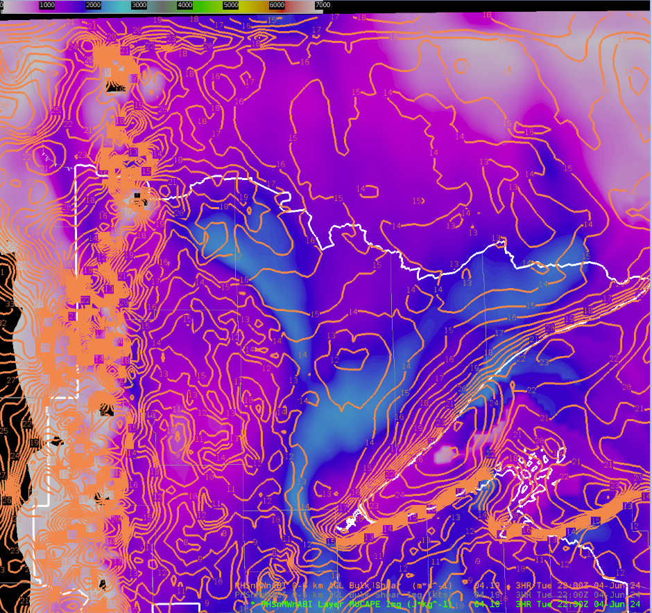
PHS fields across the region suggest weakening deep layer shear but increasing instability to the east. This generally falls in line with other guidance (SPC Meso, HRRR).
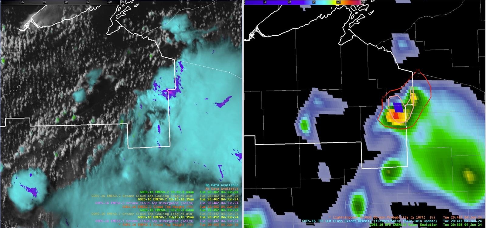
As of 2018z, interesting LightningCast signal in northern Wisconsin with 70%+ prob for greater than 10 strikes in the next hour. Not clear exactly why this is the case but it is a very strong signal moving forward. OCTANE fields for both cooling and divergence are not too intense. Cell to the west exhibited fairly strong cooling as well temporarily but appears to be weakening.
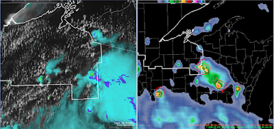
Note @ 2030z: Likely orphan anvil and more mature cells across northern Wisconsin with weaker orphan cell to the west and stronger to the east. Despite relatively few ground strikes, the GLM did produce > 10 flashes (verifying the high lightningcast probs).
And @ 2045z: Orphan anvil has totally dissipated, verifying the lightningcast low probabilities and the eastern storm steadily dissipated with weakening OCTANE divergence.
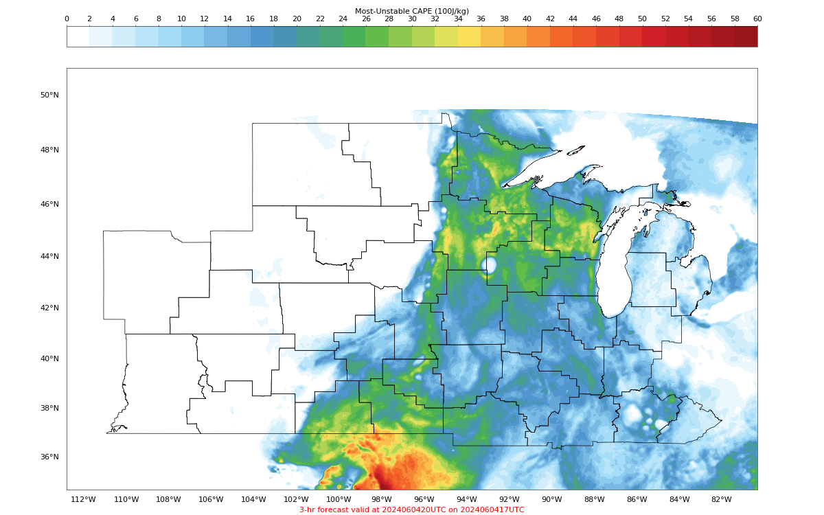
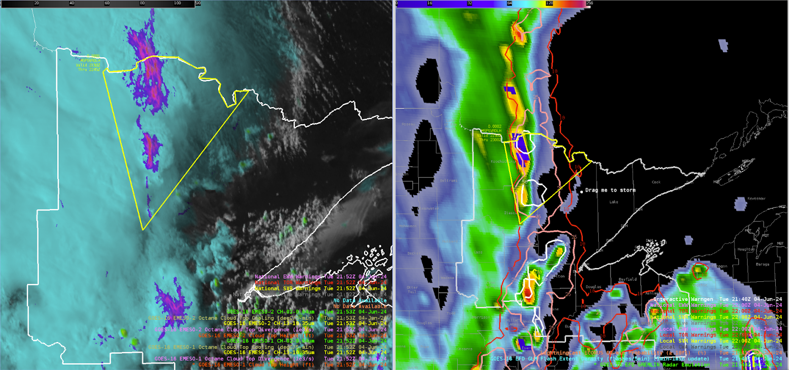
2100z: Convective coverage beginning to move closer to the Duluth area with the primary frontal band to the west and some prefrontal convection developing ahead. OCTANE cooling is lining up well with the GREMLIN coverage for these prefrontal storms, with a moderate-high signal in the lightningcast data. Still no indication of severe storms in any of the available products, PHS instability increase to around 2500 j/kg but 0-6km bulk shear falls off to around 20-25 knots. However, the instability axis looks to be displaced to east and helps explain to the not very impressive cloud top divergence in the OCTANE fields west of Duluth.

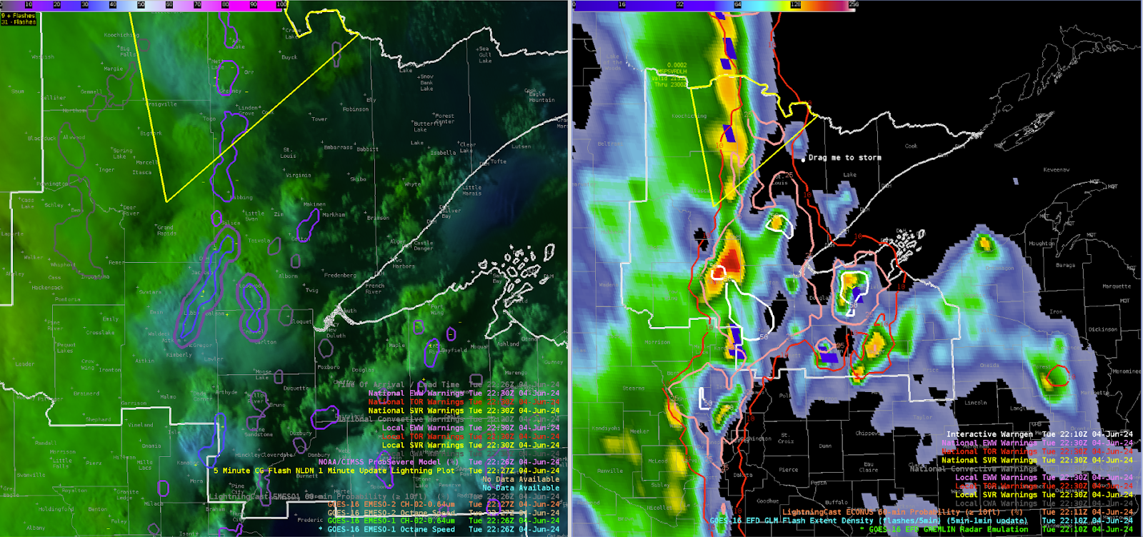
2130z: Overshooting tops seen across the northern tier of Minnesota. PHS instability and shear are maximized across this area. GREMLIN and GLM is not very impressive yet however, but cooling in OCTANE is noticeable.
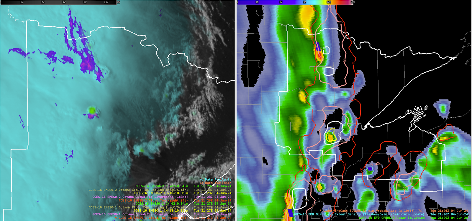
2150z: Issued a severe thunderstorm to cover the strengthening line of convection across northern Minnesota based on OCTANCE divergence, GLM, and increasing GREMLIN dBz. PHS environmental data maximized shear and CAPE across the region with 2500+ j/kg and 30-40 knots of 0-6km shear. OCTANE anvil cumulus cooling was noted for multiple times along with persistent divergence. GREMLIN radar signatures helped tune where the spatial extent of the warning would be.
2230z: Interestingly strong signal in the GREMLIN west of Duluth. Unclear exactly why, OCTANE and GLM are not very impressive at least relative to other storms today.
-Hellothere

